Geographical coordinates determine a location system, structured by invisible lines drawn in parallel, and the combination of these lines creates addresses and levels.
When carrying out a project with the BIM methodology, the BIM modeller must determine the geographic coordinates of the model, in order to orient itself in the three-dimensional Cartesian space.
However, an allotment has its geographic information. Thus, the projected building will be positioned in relation to the origin of the land, and from there follows a hierarchy in the elaboration of the model, where the levels are assigned to the reference of the building, and the objects relative to the floors. In this way, the system in .IFC format uses its coordinates from this concept.
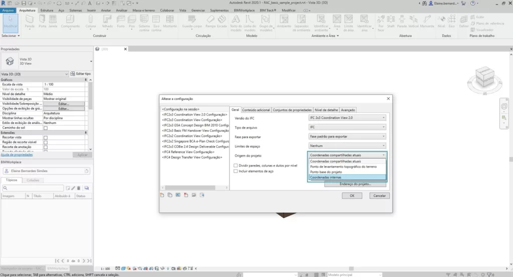
Revit software users who export models to .IFC format have the option to choose the orientation of the model’s coordinates, either by Internal Coordinates, Project Base Point, Land Survey Point, or Shared Coordinates.
On the other hand, in the case of importing models in .IFC format into the Revit software, this is based on Internal Coordinates. Therefore, when exporting .IFC models, you should always consider the internal coordinate as the model coordination, so that there are no differences depending on the file type.
Coordinate Points:
![]() Internal Coordinate
Internal Coordinate
![]() Project Base Point
Project Base Point
![]() Land Topographic Survey Point
Land Topographic Survey Point
Export from .IFC: